
When Should You Use Drone Photography? A Complete Guide for Estate Agents, Developers and Property Professionals
Discover when drone photography adds real value to property marketing — which properties benefit most, when it isn't necessary, and how aerial imagery helps listings stand out.
Key Takeaways
- Drone photography is most valuable when context, land or views are key selling points.
- Country estates, coastal homes, farms, developments and commercial sites benefit most from aerial imagery.
- Small flats and densely enclosed urban properties rarely need drone shots.
- Aerial stills and video combine powerfully with photography, floor plans and virtual tours.
- Professional operators follow CAA rules, insurance and risk assessments for safe, legal flights.
Property photography has evolved dramatically over the past decade, and one of the biggest innovations has been the use of drone photography.
Aerial images can transform the way a property is presented, giving buyers and investors an entirely different perspective that simply isn't possible from ground level. However, drone photography isn't the right choice for every property.
In this guide, we'll explain exactly when drone photography should be used, when it isn't necessary, and how it can help properties sell faster and attract more enquiries.
What Is Drone Photography?
Drone photography uses a remotely piloted aircraft equipped with a high-resolution camera to capture images and video from above.
Unlike satellite imagery or elevated poles, drones can capture unique viewpoints from virtually any angle, showcasing:
- Entire properties
- Gardens and grounds
- Plot boundaries
- Surrounding countryside
- Nearby amenities
- Waterfront locations
- Coastal views
- Commercial premises
- Development sites
Professional drone photography creates striking marketing images that immediately stand out on property portals and social media.
When Should You Use Drone Photography?
Drone photography is particularly valuable when the property's surroundings are just as important as the building itself.
1. Large Country Homes
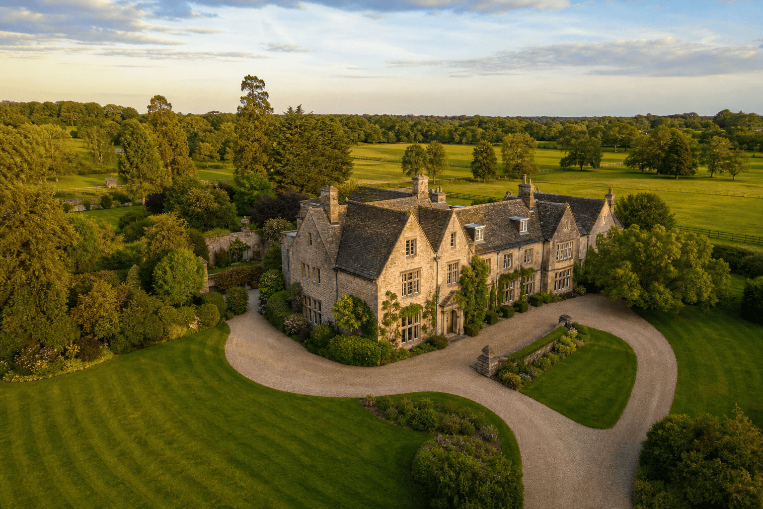
If a property sits within substantial gardens or private land, buyers want to understand the scale of the estate.
Drone images clearly show:
- Boundary lines
- Driveways
- Woodland
- Paddocks
- Swimming pools
- Tennis courts
- Outbuildings
- Guest accommodation
Instead of relying on multiple ground photographs, one aerial image can tell the whole story.
2. Coastal Properties
One of the biggest selling points of many coastal homes is their proximity to the sea.
A drone can reveal:
- Beach access
- Sea views
- Coastal walks
- Clifftop positions
- Marinas
- Harbours
These are often impossible to communicate from ground level.
3. Waterfront Homes
Properties overlooking rivers, lakes or canals benefit enormously from aerial imagery.
Potential buyers can immediately understand:
- Water frontage
- Moorings
- Private docks
- River access
- Flood defences
- Surrounding landscape
4. Farms and Rural Properties
Agricultural properties often include:
- Fields
- Barns
- Farm buildings
- Access roads
- Woodland
- Lakes
Drone photography allows buyers to appreciate the layout of the entire holding without studying complicated maps.
5. New Build Developments
Developers frequently use drones throughout construction.
Drone photography can showcase:
- Site progress
- Overall development layout
- Nearby schools
- Parks
- Transport links
- Green space
- Future phases
It is also an excellent way to produce regular construction updates for investors and purchasers.
6. Commercial Property
Commercial buyers often care as much about accessibility as the building itself.
Drone imagery helps demonstrate:
- Parking
- Loading areas
- Vehicle access
- Industrial estates
- Nearby roads
- Motorway connections
- Logistics facilities
This provides valuable context before prospective buyers even arrange a viewing.
7. Development Land
Vacant land can be difficult to market using traditional photography.
Drone images reveal:
- Site boundaries
- Topography
- Existing access
- Adjacent buildings
- Utilities
- Nearby infrastructure
This is particularly useful for planning applications and investment marketing.
8. Luxury Homes
Premium properties deserve premium marketing.
Drone photography helps communicate:
- Architectural design
- Landscaping
- Outdoor entertaining areas
- Swimming pools
- Roof terraces
- Garden design
Luxury buyers increasingly expect professional aerial imagery as part of a high-quality marketing package.
When Drone Photography Isn't Necessary
Although drones are incredibly useful, they don't always add value.
Examples include:
- Small flats
- Mid-floor apartments
- Terraced houses with limited outdoor space
- Urban properties surrounded by neighbouring buildings
- Homes where there are no significant external features
In these situations, professional ground photography often provides everything buyers need.
Benefits of Drone Photography
Show the Bigger Picture
Traditional photography focuses on individual rooms.
Drone photography shows:
- Position
- Context
- Setting
- Neighbourhood
- Orientation
This helps buyers understand exactly where the property sits.
Stand Out on Property Portals
Properties with striking aerial photography naturally attract attention when buyers scroll through Rightmove, Zoopla and OnTheMarket.
More attention often leads to:
- More clicks
- More viewings
- Greater engagement
Improve Social Media Marketing
Aerial images perform exceptionally well across:
- YouTube
- TikTok
They are eye-catching and highly shareable.
Build Buyer Confidence
Showing the complete property reduces uncertainty.
Buyers can better understand:
- Boundaries
- Neighbouring buildings
- Parking
- Garden size
- Local surroundings
This often leads to more informed enquiries.
Drone Photography or Drone Video?
Still photography is excellent, but combining it with aerial video creates an even more engaging experience.
Aerial video can demonstrate:
- Approaching the property
- Garden walkthroughs
- Surrounding countryside
- Coastal settings
- Development progress
When combined with professional property photography and floor plans, it creates a comprehensive marketing package.
Can Drone Photography Be Combined with Virtual Tours?
Absolutely.
Many estate agents now combine:
- Professional photography
- Floor plans
- Drone photography
- Drone video
- 360° virtual tours
- Matterport digital twins
This allows buyers to explore every aspect of a property before arranging a viewing.
Learn more about our 360° Virtual Tours and Matterport Digital Twins to create an even more immersive viewing experience.
Is Drone Photography Safe?
Yes — when carried out by trained, qualified professionals.
Professional operators follow UK Civil Aviation Authority (CAA) regulations, including:
- Safe operating distances
- Airspace restrictions
- Privacy requirements
- Risk assessments
- Appropriate insurance
- Weather considerations
This ensures flights are conducted safely and legally.
Why Choose Photoplan?
At Photoplan, we provide professional drone photography alongside a full suite of property marketing services, including:
- Property Photography
- Floor Plans
- Drone Video
- 360° Virtual Tours
- Matterport Digital Twins
- Property Videography
- Virtual Staging
- CGI & Visualisation
By combining these services, we help estate agents, developers and commercial property professionals present every property at its very best.
Whether you're marketing a country estate, a coastal apartment, a commercial building or a new development, our experienced team can recommend the right combination of photography and visual marketing to maximise interest.
Ready to elevate your next property listing? Contact Photoplan today to discuss how professional drone photography can help your property stand out.
- #drone photography
- #aerial photography
- #property marketing
- #estate agents
- #property developers
- #commercial property
Frequently Asked Questions

The Photoplan Team
Property Media Specialists
The Photoplan team produces property photography, floor plans, tours, video and CGI that help estate agents, developers and commercial clients market property beautifully.
Ready to market your next property?
Book a Photoplan specialist online in minutes, or get in touch to discuss account pricing for your agency.
Estate agents book through the app · One-off customers order in the shop · or contact us
Related Articles

Drone Property Photography Services UK: When Aerials Earn Their Fee
Drone property photography services are not an automatic upsell. Here is when UK aerial property photography is worth booking — and the compliance basics agents should check.
UK Drone Rules for Property Photography in 2026: What Estate Agents Need to Know
UK class marks arrived in January 2026 and the rules around flying near people have changed. Here's what the CAA regulations mean for aerial property photography — and what agents should check before booking a drone operator.
Aerial Drone Video and Photography for Property Marketing
What aerial drone video and photography add to a property listing, when they're worth the money, what UK rules apply and what you should expect to pay in 2026.